Contents
Stretching across seven states, the Arkansas River is one of the major tributaries of the Mississippi River that runs from Colorado’s Rocky Mountains to the heart of Arkansas. It is the sixth-longest river in the United States and the 45th in the world, boasting diverse ecosystems, breathtaking landscapes, ample recreational opportunities, and a rich cultural history intertwined with the Native American heritage, early explorers, and pioneers.
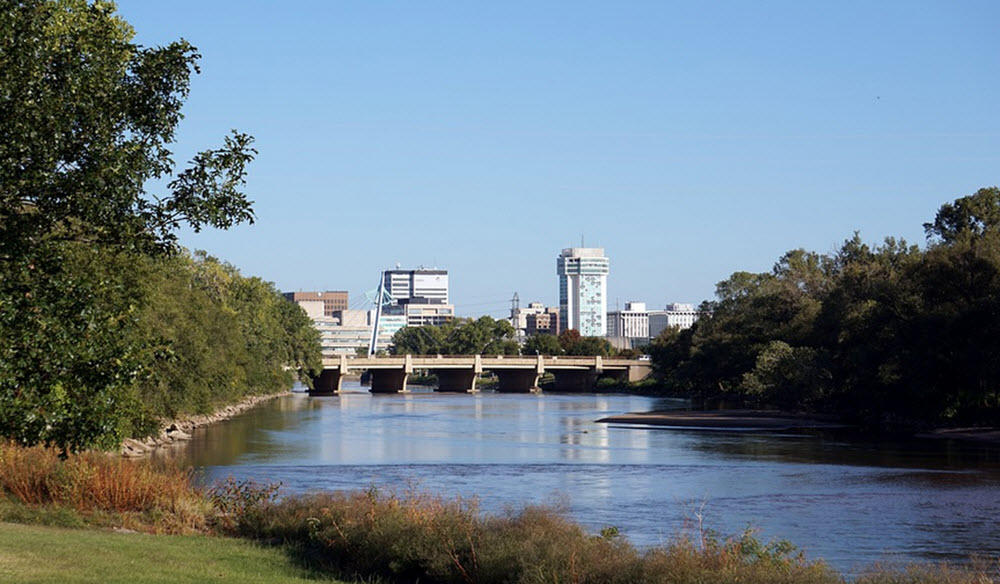
Several notable cities and towns have developed along this river, such as Canon City, Peublo, Garden City, Dodge City, Wichita, Tulsa, Fort Smith, and Little Rock.
The Arkansas River is more than a geographical feature; it’s an important aspect of North American history, a treasure chest of bio-diversity, and a provider of recreational joy. It continues to course through the heartland of America, touching lives and landscapes with its powerful flow, weaving a tapestry of ecology, adventure, history, culture, and commerce.
Interestingly, the path of the Arkansas River has changed over time, and sediments unvealved in a palaeochannel next to Nolan in the Tensas Basin show that part of the river meandered here until circa 3200 BCE.
Source and course
The source of the Arkansas River is the snowfields of Colorado; roughly 14,000 feet above sea level in the Rocky Mountains – more exactly the Sawatch and Mosquito mountain ranges. Soon after, it takes a 1,469-mile long turn, cutting through the rugged terrains of Kansas, Oklahoma, and Arkansas before it reaches the Mississippi River. The Arkansas River is majority tributary of the Mississippi River. With a length of 1,469 miles, it is the sixth-longest river in the United States, and the second-longest tributary in the Mississippi-Missouri system.
The Arkansas River kan be divded into several sections:
- The headwaters, which starts close to Leadville in the mountains of Colorado. During this section, the Arkansas is a steep fast-flowing mountain river. Over just 120 miles, its altitude drops from by 4,600 feet.
- At Cañon City, Colorado, the river valley becomes broader and the terrain flatter. West of Pueblo, Colorado, the river reaches the Great Plains and becomes a typical flat-land river, with wide, shallow banks. Through the final section of its Colorado run, througout Kansas, and into much of Oklahoma, this is a flat-land river with seasonal floodings and seasonal periods of decreased flow. Examples of notable tributaries during this section are Cimarron and Salt Fork Arkansas.
- The river becomes even wider in eastern Oklahoma. A series of locks, dams and reservoirs have been created on the Arkansas and several of its tributaries to maintain more predictable flow rates and make it possible for barges and other larger river boats to navigate.
- As the river enters western Arkansas, it works its way between the Boston and Quachita mountains. Somewhat west of Little Rock, the river valley begins to expand and the terrain becomes flatter. The river then proceeds eastward across the flat plains and forests of Arkansas until it reaches the Mississippi River near Napoleon, Arkansas.
Ecology
The river’s diverse terrain invites a unique diversity in flora and fauna and ther river and its surroundings hold a grand ecological value. Its plains, ridges, valleys, and shores provide a nurturing environment to numerous species of plants, animals, and birds.
Along parts of the river, Eastern Cottonwood trees line the river bank and playful North American river otters animate the river’s currents. Birdwatchers can marvel at species like the Blue Heron, the American Eagle, and the endangered Interior Least Tern. The river environment is equally rewarding for herpetologists, providing a habitat to rare turtles and snakes.
The water flow in the Arkansas River has dropped significantly since the 1960s, chiefly due to the pumping of groundwater for irrigation in eastern Colorado and western Kansas. In the period 1944-1963, the water flow in the river – measured in central Kansas – was roughly 248 cubic feet per second. For the 1984-2003 period, it was just 53 cubic feet per second.
Recreational opportunities
The Arkansas River offers a plethora of recreational activities, attracting constellations of tourists from around the globe. Its upper reaches in Colorado are popular destinations for thrilling white-water rafting and fly fishing. Later on, magnificent flatter landscapes and calm stretches of water provide ideal settings for boating, kayaking, and paddleboarding.
The scenic Arkansas River Trail, stretching across 88 miles, is perfect for hiking, running, biking, and provides stunning views of the river’s flora and fauna. Additionally, the river’s shores offer abundant picnic spots and campgrounds for family outings.
Fishing
The headwaters of the Arkansas River is Colorado are famous for its trout and is somewhat of a Mecka for fly fishers. Back in the 1800s, greenback cutthroat trout was especially plentiful, but today brown trout is more common. Rainbow trout is also found here.
The stretch from Leadville to Pueblo has many fly shops and fishing guide operations.
For more information about fishin in the headwaters, contact Colorado Parks and Wildlife (cpw.state.co.us).
Historical and cultural significance
The historical and cultural significance of the Arkansas River is rooted in Native American culture, early explorers like Zebulon Pike, and American frontiersmen. For thousands of years, Native American peoples have been living near the river. This river also served as the southern boundary of the 1803 Louisiana Purchase and was a notable segment on the Trail of Tears following the Indian Removal Act of 1830. Many cities and towns, including Little Rock, Wichita, and Pueblo, developed along its banks, turning the river into an economic artery and cultural spine of the region.
The first Europeans to see this river were probably the members of the Spanish Coronado expedition who reached it in June 1541. This was also the decade when Hernando de Soto reported back about the junction between the Arkanas and the Mississippi River.
Early Spanish explorers called the river Napeste, but in 1673 the French priest Father Jacques Marquette referred to it as Arkansa in his journal.
In 1718-1719, the French noblemand and trader Jean-Baptiste Bénard de la Harpe led reported that by the river, which he called Alcansas, he and his group – which included three guides from the Caddo people – encountered a Native American settlement overlooking the river. This settlement was home to around 6,000 people and they gave the visitors a warm welcome, honoring them with a pipe ceremony.